News/Events
Back
News
Events
Resources
Back
videos
Case Studies
Articles
CONTACT US
Home
Presentations
Back
Webinars
TMTW presentations
Video Cases
Training
Back
Product training
Software training
Product Overviews
Back
Top 5 reasons
Demos
Brands
Back
AG Geophysical
Benthos
BlueView
Bowtech
Cable Solutions
Cormon
DGO
Gavia
Impulse
Impulse PDM
Oceanscience
ODI
Odom Hydrographic
PDS
RD Instruments
RESON
SeaBotix
TSS
Webb Research
MARINE Channel
Home
Training
Product training
Software training
PDS training
Demos
Brands
AG Geophysical
Benthos
BlueView
Bowtech
Cable Solutions
Cormon
DGO
Gavia
Impulse
Impulse PDM
Oceanscience
ODI
Odom Hydrographic
PDS
RD Instruments
RESON
SeaBotix
TSS
Webb Research
Video Contest 2026
<p>Your web browser does not support iframes, which means that the video cannot play.</p>
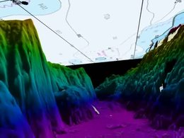
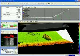
Deep water seafloor mapping using a SeaBat 8160
Deep water seafloor mapping using a SeaBat 8160 multibeam sonar.
Get more information about the
SeaBat 8160
Deep water seafloor mapping using a SeaBat 8160
1.25
1158
Share
Embed
Email
Download
Link to share
Embed this video
Send to a friend
Send
Download this video
Standard
(1MB)
HD
(2MB)
Download this video
Standard video
(1 MB)
HD video
(2 MB)
02:31
Deep water seafloor mapping near St Thomas -using SeaBat...
4,443 views
01:13
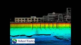
Photorealistic quay side inspection using laser and...
3,735 views
01:02
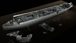
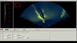
ADUS/Reson survey trial on SS Breda using SeaBat 7125
3,626 views
03:04
Survey of Port of Constanza in Romania Part 1
3,493 views
01:57
Speed boat discovered using a SeaBat 7125 in Lake Conroe
3,011 views
03:05
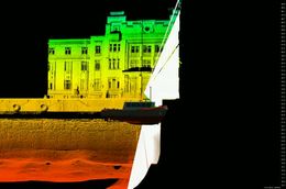
Wreck survey of the HMS SCYLLA using a Seabat 7128
2,960 views