Surveying in the most remote place in the world, Antarctica
Navigation data is poorly available in Antarctica. If navigational data is available it often dates back to the early 1900s with many lead line surveys. An initiative was undertaken by Stephen Wilkins of Xplore Expeditions to collect bathymetry with a multibeam SeaBat 7125-SV2 survey system making use of the sailing vessel Xplore. Together with Yoann Boulaire from SHOM, France and Fernando Landeta, hydrographic technician from Skyring Marine Chile, an IHO qualified survey was performed in Antarctica on an expedition sailing yacht.
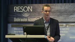
See a presentation of the project recorded in September at the Teledyne RESON Underwater Technology Seminar in Copenhagen.

