Tagged with lidar
Teledyne Marine Webinars
Marine Technology Webinar Series_ Autonomous Surface Vehicles_ Sonar and Lidar Data Overlay and...
Join Teledyne Marine’s Vitad “V” Pradith for this webinar hosted by the Marine Center at Northwestern Michigan College. V will share examples of how smaller USVs, such as the Teledyne Oceanscience Z-Boat, has increased mapping/surveying abilities...

Teledyne Marine Webinars
Mapping the Great Pacific Garbage Patch
Presenter: Jen Aitken, Research Scientist/Product Manager, Teledyne Optech The Pacific Ocean is a hotspot for waste that we dump from our coastal cities or lose overboard from ships. Its currents push the trash into the middle of the ocean...
RESON data
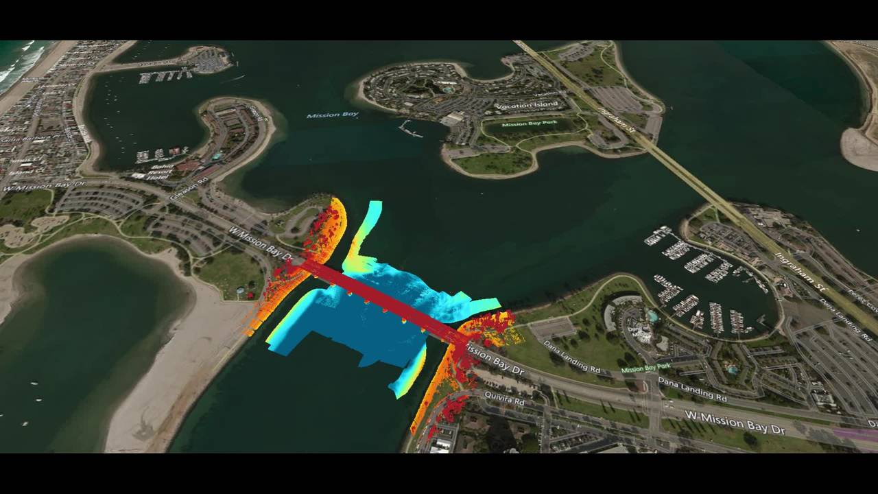
Teledyne Multibeam and Laser Solution Demonstrated at TMTW 2019 in San Diego
The inspection of a bridge above and below the water line in a single survey was demonstrated by Teledyne RESON and Teledyne Optech during TMTW 2019 in the Mission Bay area in San Diego. Complete dataset acquired, processed and plotted as a...
Teledyne PDS
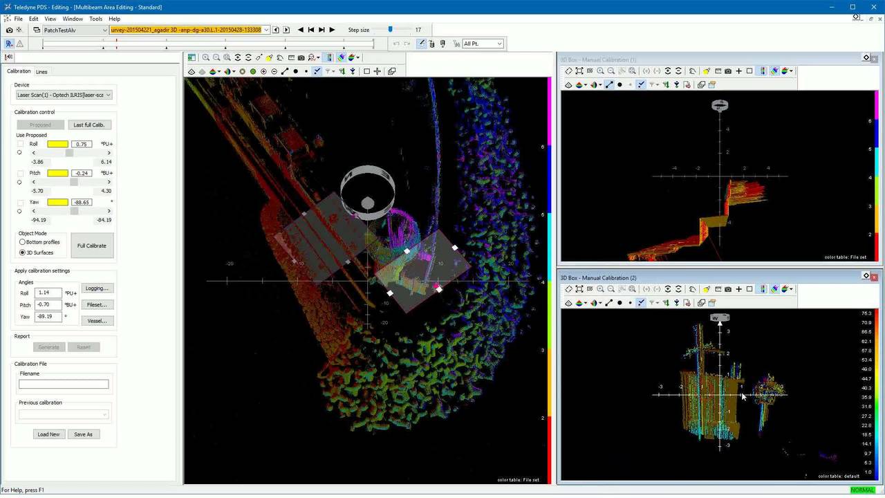
Teledye PDS - LiDAR laser mounting angle calibration
This video demonstrates how to calibrate the mounting angles of a LiDAR laser device from the Teledyne PDS Calibration utility. If you have any comment / question / remark about the video content please contact [email protected]!
Video white papers
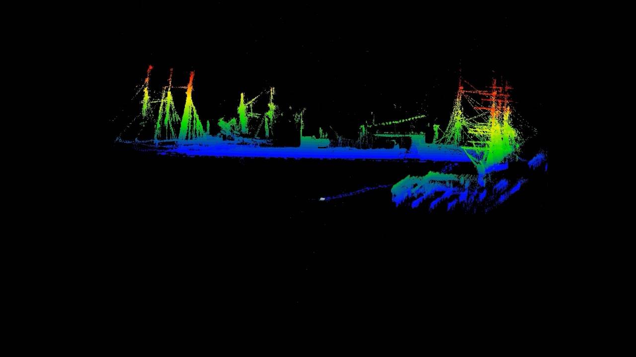
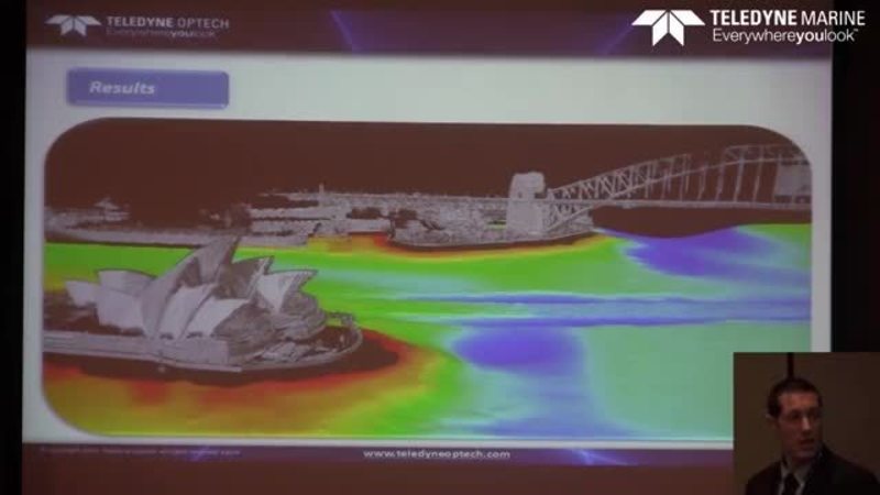
Combined Laser/Multibeam Sonar Survey of Sydney Harbor
By Dario Conforti - Teledyne Optech Combined Laser/Multibeam Sonar Survey of Sydney HarborTeledyne Optech has been a world leader in the design, development and manufacture of advanced lidar instruments for 40 years. In the last few years Teledyne...
Video white papers
New Techniques for Bridge and Structure Inspection
“Combining Scanning Sonar, Laser Scanning and Mobile Mapping to Provide New Techniques for Bridge and Structure Inspection.” By Tom Card, LandScope Engineering Ltd Summary of paper: With regards to bridges and other underwater structures,...

Case stories
The grain LNG Terminal surveyed
In 2010, the PLA were commissioned by the National Grid to survey the riverbed surrounding Jettiew 8 10 at the Grain LNG Terminal. The data was collected by the combined vessel-mounted laser SeaBat 7125 Multibeam sonar arrays. We thank Port...