Tagged with data_video
RESON data
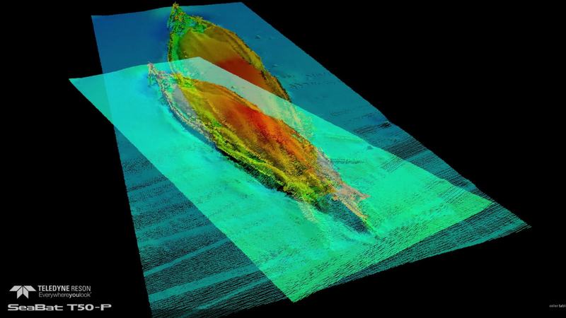
Data images from the Multibeam Survey of the HMS Hampshire wreck site
Earlier this year Teledyne RESON was invited by Seatronics to assist with the mapping of HMS Hampshire. HMS Hampshire sank on the 5th June 1916 when she struck a mine laid by German U-Boat U75. The wreck is located in approximately 60 meters of...
RESON data
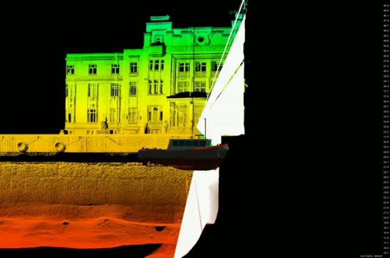
Survey of Port of Constanza in Romania Part 2
Port of Constance (Romania) surveyed using the SeaBat 7125 with POS MV Wavemaster and Riegle VZ400 laser scanner all collected and calibrated with Teledyne PDS. Go to part 1 Get more information about PDS2000 Software or the SeaBat 7125
Your stories
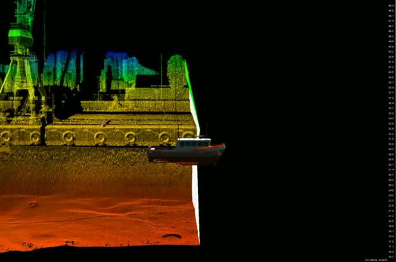
Survey of Port of Constanza in Romania Part 1
Port of Constance (Romania) surveyed using the SeaBat 7125 with POS MV Wavemaster and Riegle VZ400 laser scanner all collected and calibrated with Teledyne PDS. Go to part 2 Get more information about Teledyne PDS Software or the SeaBat 7125...