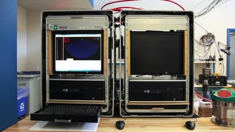
Tagged with seabat 7125
Marine Tech Talk Podcast
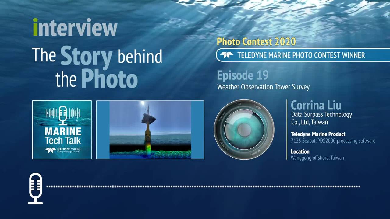
Weather Observation Tower Survey for Offshore Wind Power
Guest: Corrina Liu, Data Surpass Technology Co., Ltd, Taiwan In this fall series of podcasts, we introduce some of the winners and general entrants from the 2020 Teledyne Marine Photo Contest. Teledyne’s annual Photo/ Data Contest concluded with...
Case stories
Video – Exploring the deepest ocean Part III
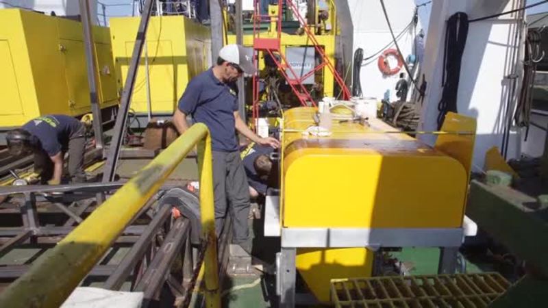
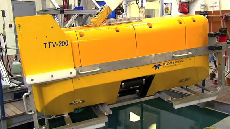
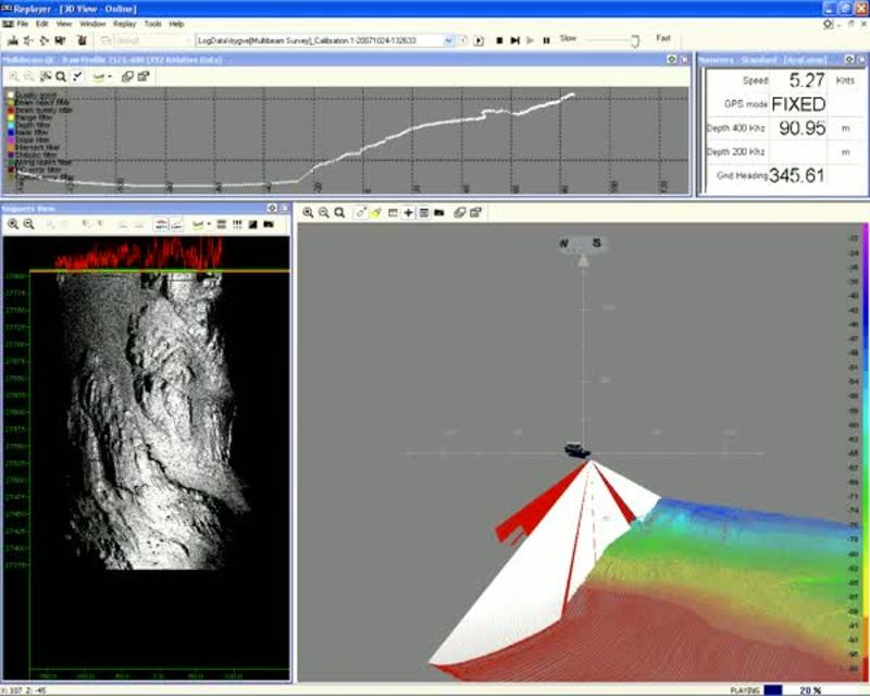
Deep Tow Project Part III – Installation at Odyssey Marine ExplorationTeledyne Benthos and Teledyne RESON are developing a new deep tow vehicle for Odyssey Marine Exploration. The vehicle is equipped with a SeaBat 7125 Multibeam Dual Head Sonar...
Video white papers
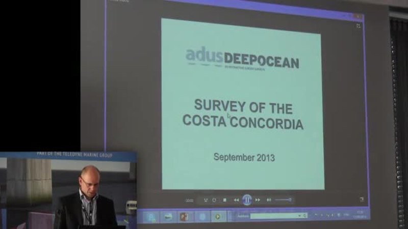
High-quality surveys of man-made structures as an aid to improved decision making
By Stuart Leather, Business Development Director, ADUS, DeepOcean
Case stories
Video – Exploring the deepest ocean Part II
Deep Tow Project Part II – Assembling Testing at Teledyne BenthosTeledyne Benthos and Teledyne RESON are developing a new deep tow vehicle for Odyssey Marine Exploration. The vehicle is equipped with a SeaBat 7125 Multibeam Dual Head Sonar and...
Case stories
Video – Exploring the deepest ocean Part I
Deep Tow Project Part I – Getting started Teledyne Benthos and Teledyne RESON are developing a new deep tow vehicle for Odyssey Marine Exploration. The vehicle is equipped with a SeaBat 7125 Multibeam Sonar and will be used to find shipwrecks on...

Case stories
The grain LNG Terminal surveyed
In 2010, the PLA were commissioned by the National Grid to survey the riverbed surrounding Jettiew 8 10 at the Grain LNG Terminal. The data was collected by the combined vessel-mounted laser SeaBat 7125 Multibeam sonar arrays. We thank Port...

Video white papers
Video paper: Pipeline surveying from a surface vessel in the Caspian sea
Surface Vessel Based Multibeam Pipeline Inspection In a special collaboration between BP, Fugro Caspian and Teledyne RESON an unconventional approach was used to survey pipelines in the Caspian Sea. A vessel was outfitted with two pole mounts...

Video white papers
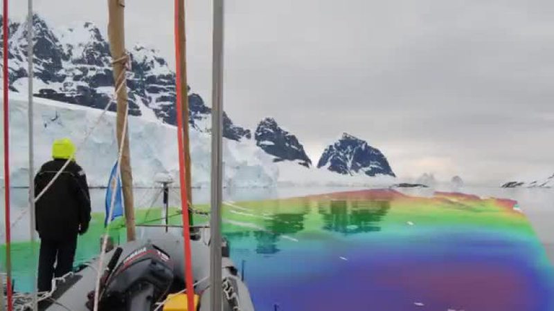
Surveying in the most remote place in the world, Antarctica
Navigation data is poorly available in Antarctica. If navigational data is available it often dates back to the early 1900s with many lead line surveys. An initiative was undertaken by Stephen Wilkins of Xplore Expeditions to collect bathymetry...
Contest
Suspended sediment over Mississippi sand-dune
Whats seen: Large plumes of suspended sediment entrained from the bed by turbulence advecting with flow over the lee-side of an alluvial sand-dune. Data were collected from a boat moored at a point at a 10Hz ping repetition frequency, at 400kHz...
Case stories
Hydrography in Antarctica on sailboat Xplore
About the data survey: The data was collected and corrected of real tide and sound speed.SVP 70and AML profiler sound speed.The differencial GPS Hemisphere was in HP G2 OmnistarAll data will be used for chart production according to IHO standards....
Contest
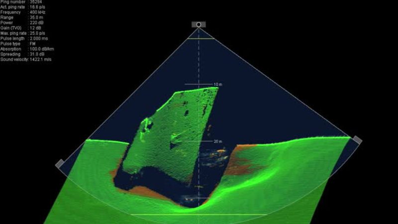
The sunken wreck of the 'Jan Heweliusz'
The video shows the finding of the ferry Jan Heweliusz which sunk in a hurricane in 1993. The Ship lies on the bottom of the Baltic Sea under 27 meters of water. In the video we are witnessing the survey through the SeaBat user interface from the...
Contest
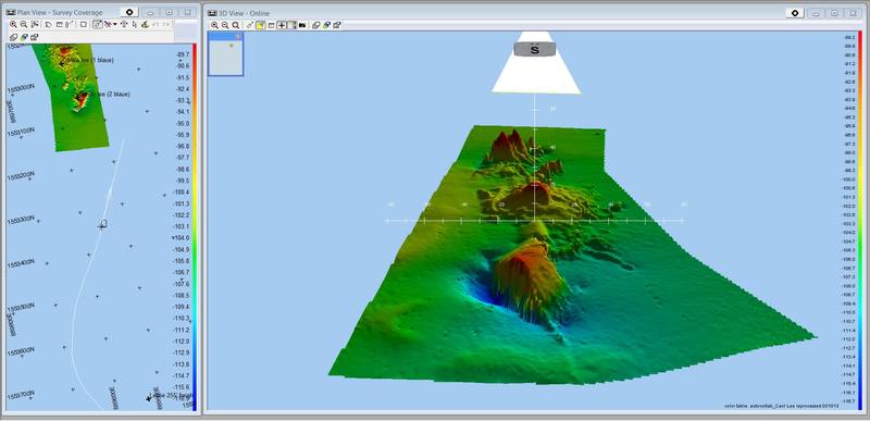
SS Leslie aka The Carol Lee Wreck
SS Leslie The SS Leslie was built in 1919 in Duluth, Michigan, as the Lake Flagstaff. She later sailed under the names Stella Lykes and Josephine, before being renamed Leslie. She was 251 feet long, had a 44 foot beam and displaced 2,609 gross...
Contest
The Dutch Wreck
"Dutch Wreck" -- Steamship Laertes The Dutch steamship Laertes was built in 1919 by Taikoo Dockyard Engineering Company, Hong Kong. Owned by Nederland Stoomy, she was 423.9 feet long, had a 52.3 foot beam, displaced 5,825 tons and was pushed by a...
Contest
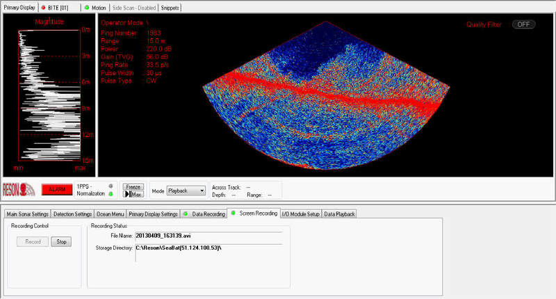
SeaBat 7125-SV2 tracking exposed pipeline in SeaBat UI
New SeaBat 7125-SV2 User Interface, wedge display with history turned on, tracking an exposed pipe with noticeable free span on a slope. At the end, start playing with Flex Mode.
Our stories
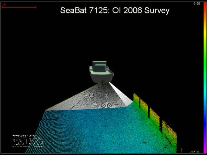
Hydrographic survey in the port of London with a SeaBat 7125
Hydrographic survey with a SeaBat 7125 multibeam sonar using Teledyne PDSs oftware in the port of London during the OI06 exhibition. Get more information about the Seabat 7125
Our stories
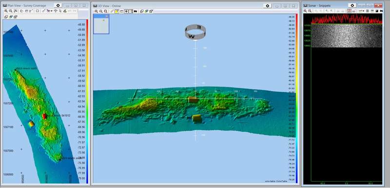
Objects seen with a 400kHz SeaBat 7125 multibeam sonar
Objects seen with a 400kHz SeaBat 7125 multibeam sonar in side scan module. Visit RESON SeaBat 7125 product page
Our stories
Wreck of Blücher SeaBat 7125 multibeam sonar survey
RESON SeaBat 7125 multibeam sonar surveys the Oslo Fiord in Norway in 2007. The wreck of the Blücher, which was a German heavy cruiser sunk during the World War II, lies on 75 meter depth.