Tagged with multibeam_data_videos
RESON data
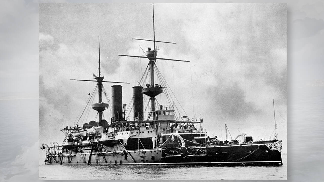
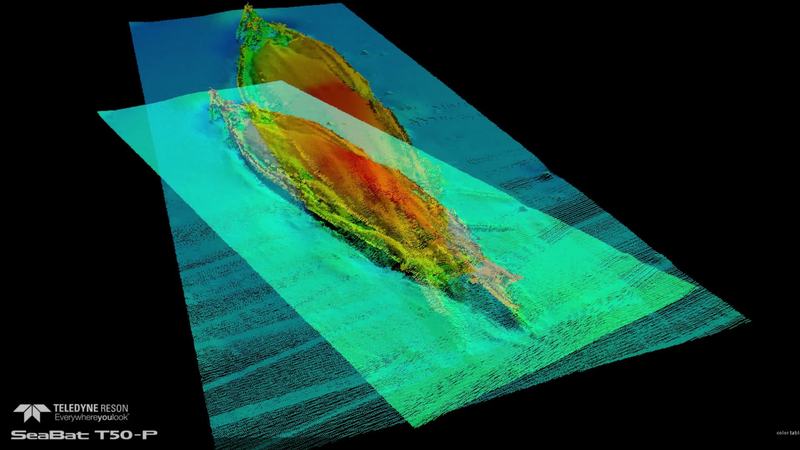
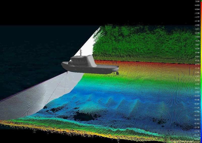
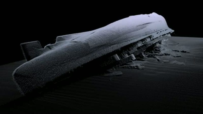
Surveying the wreck of the HMS Hood (1891)
See how Teledyne Marine surveyed the wreck of HMS Hood with the Teledyne RESON SeaBat T51 800 kilo hertz multibeam echosounder. In August 2023, Teledyne Marine set out to survey the wreck of HMS Hood (1891). The purpose of the survey was to...

RESON data
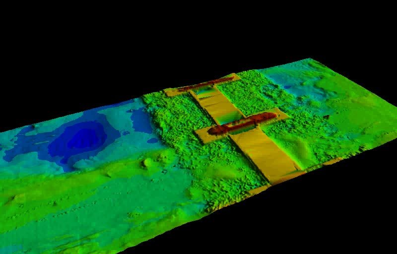
Surveying Artificial Reefs with a SeaBat T51
Artificial reefs make a great playground to produce stunning data when passed over with a SeaBat T51 at 800 kHz. But aside from that they have a more meaningful purpose. Artificial reefs...
RESON data
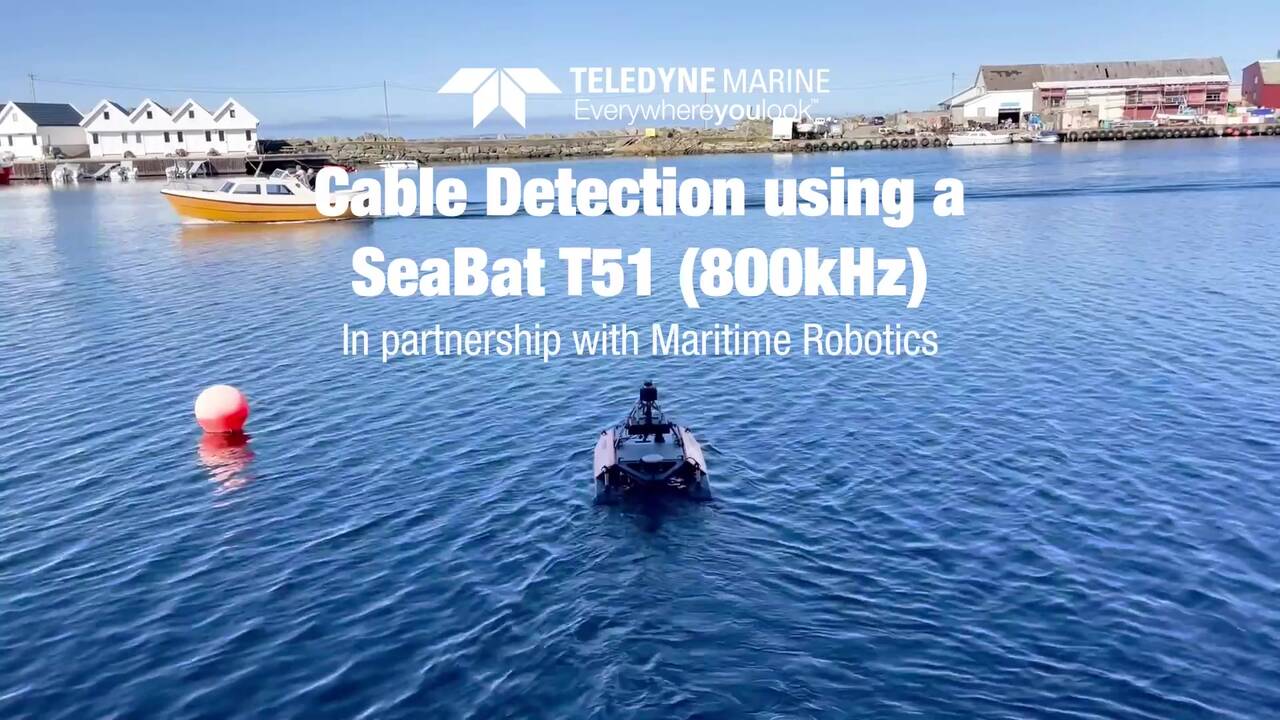
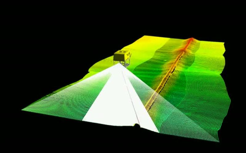
Cable Detection using a SeaBat T51 (800kHz)
Cable Detection using a SeaBat T51 (800kHz) on a maritime Robotics ASV With the finest receiver beamwidth available, the SeaBat T51 is perfectly suited to detect small objects. What’s more, the SeaBat T51 uniquely offers full swath width of up to...
RESON data
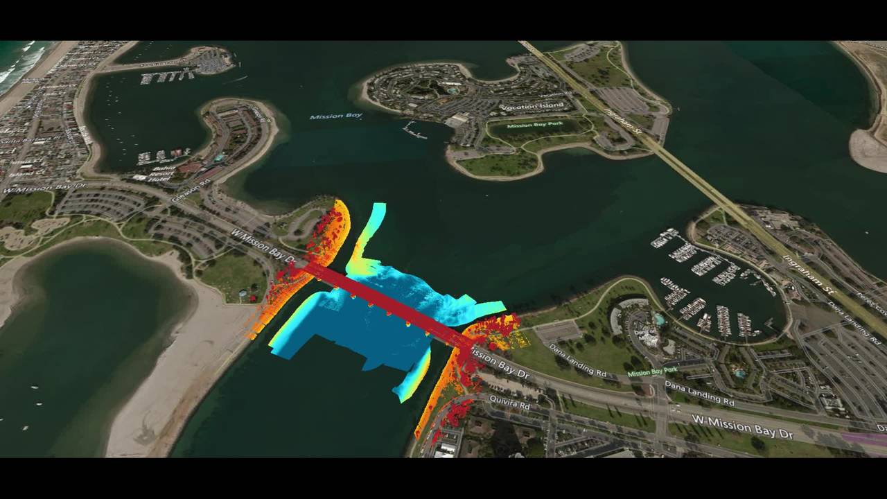
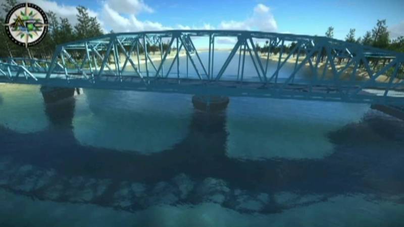
Teledyne Multibeam and Laser Solution Demonstrated at TMTW 2019 in San Diego
The inspection of a bridge above and below the water line in a single survey was demonstrated by Teledyne RESON and Teledyne Optech during TMTW 2019 in the Mission Bay area in San Diego. Complete dataset acquired, processed and plotted as a...
RESON data
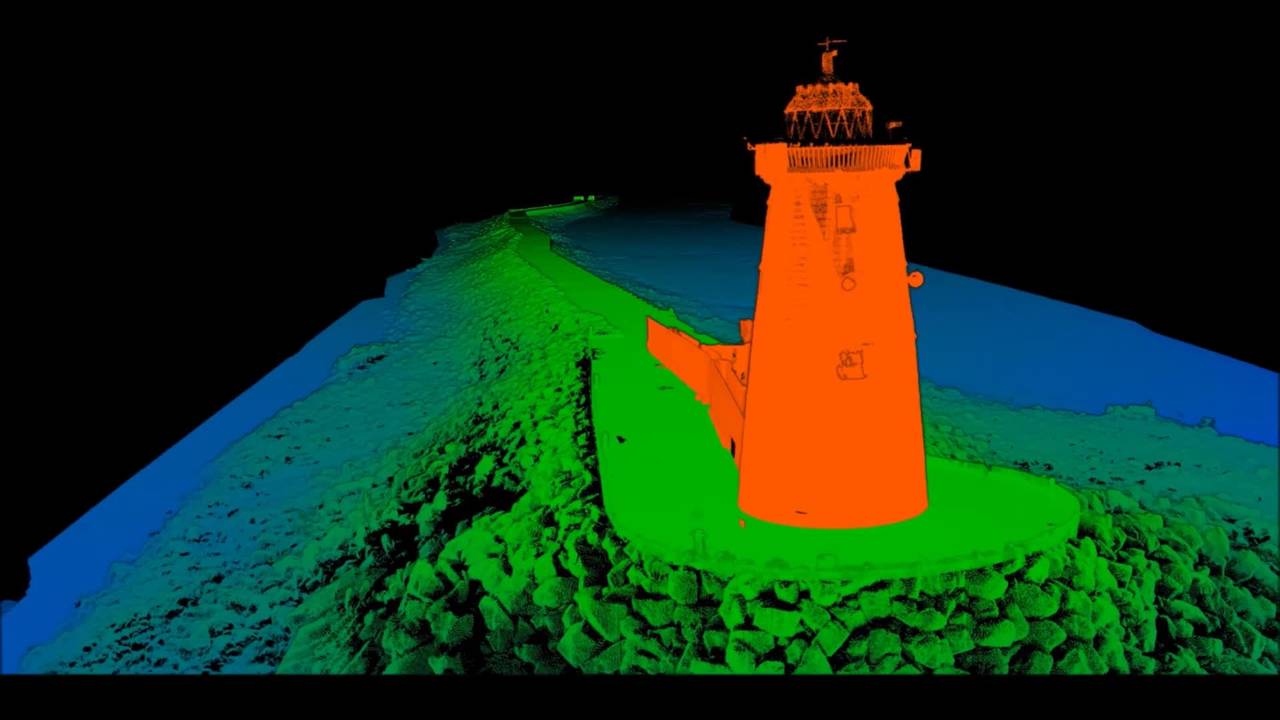
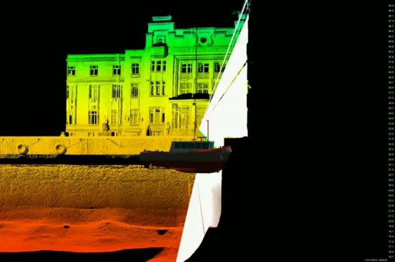
Combined Multibeam and LIDAR survay 2017
A video from a survey to monitor changes in a historical structure over time. The breakwater, which is between 200 and 300 years old and stretches for two kilometres, has suffered damage during storms many times over this period. Annual surveys...
RESON data
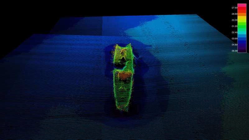
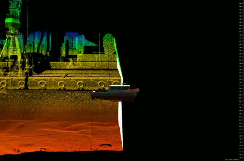
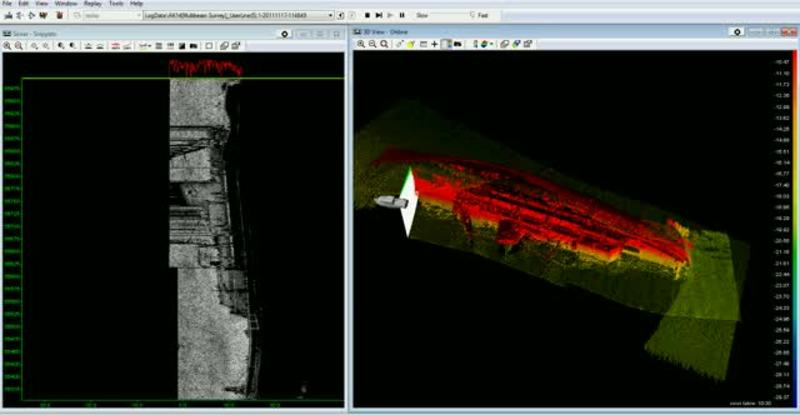
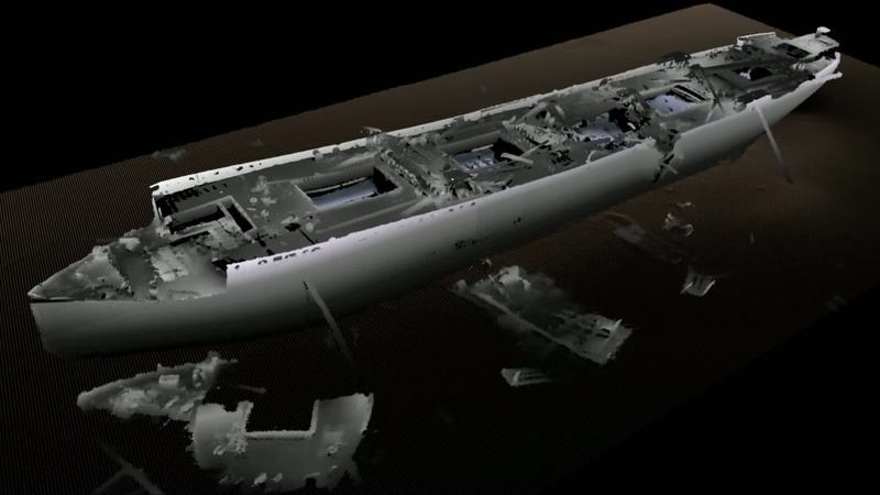
Data images from the Multibeam Survey of the HMS Hampshire wreck site
Earlier this year Teledyne RESON was invited by Seatronics to assist with the mapping of HMS Hampshire. HMS Hampshire sank on the 5th June 1916 when she struck a mine laid by German U-Boat U75. The wreck is located in approximately 60 meters of...
RESON data
Myrtle
The gunnery ship-minesweeper Myrtle was built in England in 1915. The ship arrived to Estonia during the days of the War of Independence as part of the British squadron. The ship was sweeping the German mine barriers from the sea routes. Myrtle...
RESON data
Krimulda
Latvian steamer, built in England in 1899. Hit a mine on 30 June 1941 and foundered. Five people lost their lives. http://register.muinas.ee/public.php?menuID=en_wreckregistryaction=viewid=1250 Krimulda was surveyed with a Teledyne RESON SeaBat...
RESON data
Dago
The steamship Dago was built in England in 1912 as a cargo ship. The ship was taken into use by the Russian navy during WWI, and was rebuilt as an armed minesweeper carrying the bow number 4. Dago was anchored West of Osmussaar island on 23...
Contest
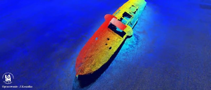
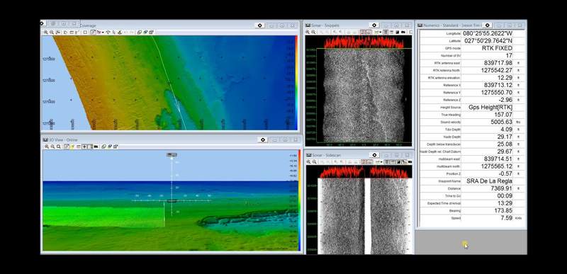
Wreck minesweeper Delfin
Where was the image taken / the data collected ?: Baltic Gulf of Puck When was image taken / the data collected ? : 2015-06-23 Which Teledyne Equipment is used ?: mbes 7125 Which processing software was used ? -Only data images and videos: QPS...

Contest
Teledyne Marine Photo & Video Contest 2016 - Data videos
We asked for your field photos, video, and data – and you came through with some amazing imagery! Our contest resulted in over 70 fantastic images, video and data sets that make us proud to be Teledyne! It’s truly rewarding to see the many fun,...
Case stories
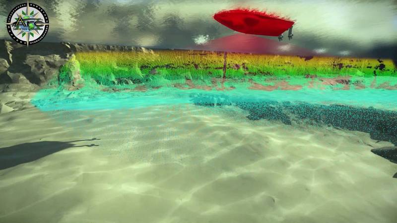
A combined laser and bathymetric survey, Sydney 2014
Teledyne RESON and Teledyne Optech have recently conducted a series of tests for the Port Authority of New South Wales, combining laser and bathymetric survey into a "seamless surface" experience.
Case stories
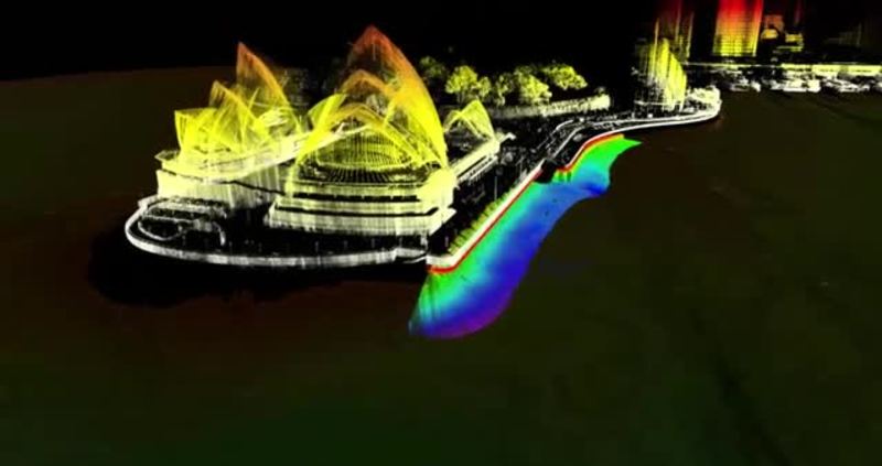
3D Sydney Harbour floor mapping
A fly trough of the Sydney Harbour sea floor mapping. Credit: www.sydneyports.com.au/ The team responsible for keeping the Harbour’s busy shipping lanes and berths clear of obstacles have now revealed some of the spectacular 3D images of the...

Case stories
The grain LNG Terminal surveyed
In 2010, the PLA were commissioned by the National Grid to survey the riverbed surrounding Jettiew 8 10 at the Grain LNG Terminal. The data was collected by the combined vessel-mounted laser SeaBat 7125 Multibeam sonar arrays. We thank Port...
RESON data
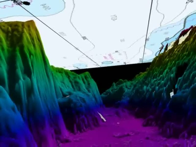
Teledyne logo found with sonar in Austin Texas
During November 19- 21 Teledyne RESON held the third and last Underwater Technology Seminar in 2013.More than 100 participants from Americas joined the event at an exclusive resort at the seashore of Lake LBJ near Austin, Texas. When surveying...
Contest
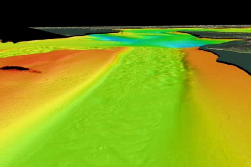
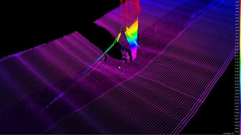
Suspended sediment over Mississippi sand-dune
Whats seen: Large plumes of suspended sediment entrained from the bed by turbulence advecting with flow over the lee-side of an alluvial sand-dune. Data were collected from a boat moored at a point at a 10Hz ping repetition frequency, at 400kHz...
Contest
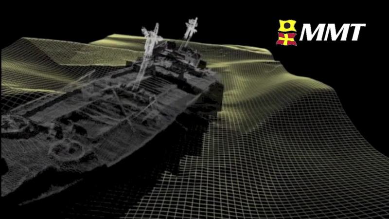
SS Richard Montgomery by MMT
Whats seen: The full wreck structure. Laser scanning data collected the masts above the water. About the data survey: The SS Richard Montgomery is a WW2 liberty ship with 1,400 tonnes of explosives still on board. The survey was performed for...
Contest
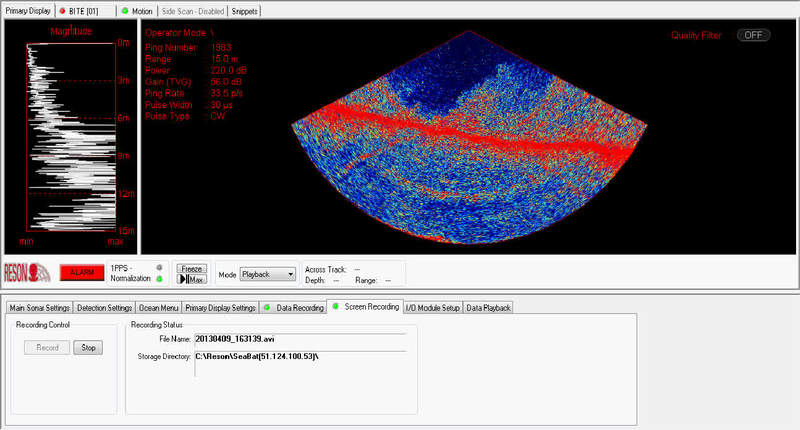
The sunken wreck of the 'Jan Heweliusz'
The video shows the finding of the ferry Jan Heweliusz which sunk in a hurricane in 1993. The Ship lies on the bottom of the Baltic Sea under 27 meters of water. In the video we are witnessing the survey through the SeaBat user interface from the...
Contest
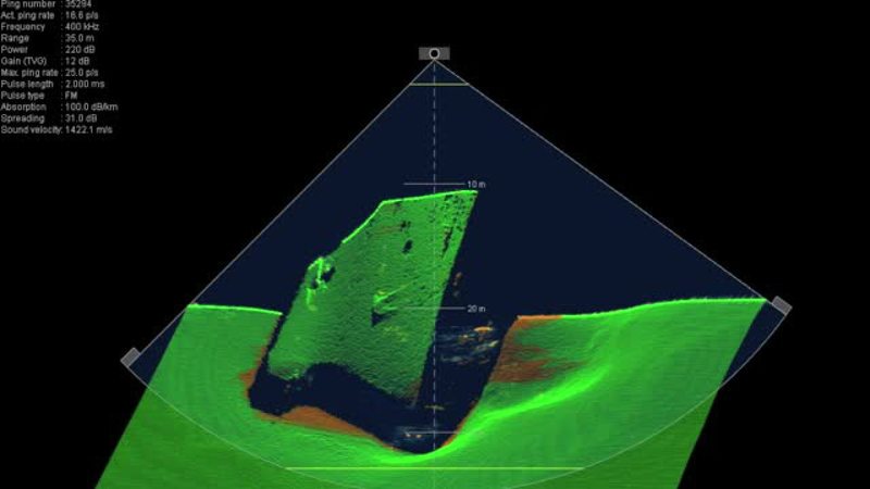
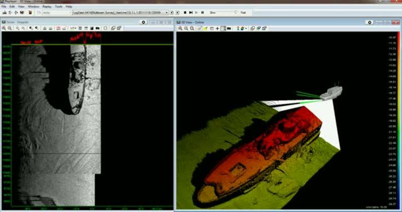
Wreck Survey In 600m Of Water
The video shows a WWI merchant vessel sunk using charges after surrendering to a German U-Boat. The bow separated from the vessel during its 600m decent to the seabed and lies half a kilometre away. No lives were lost.The video shows the 90m long...
Contest
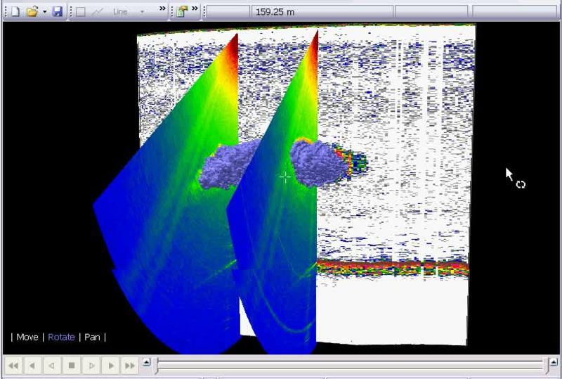
Reson 7125 SV2 Wreck investigation
The video shows the wreck Faros located in "Tanis Bay". Link to a danish site containing pictures of the wreck: http://www.vragguiden.dk/wreck.asp?id=4113 The wreck was invastigated as a part of the Danish Hydrographic Office's general survey in...
Contest
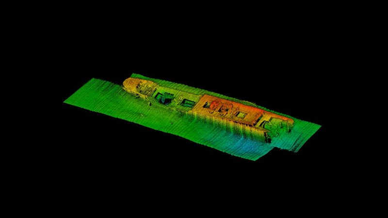
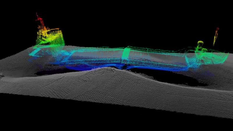
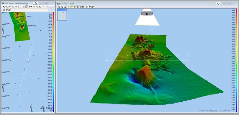
SS Leslie aka The Carol Lee Wreck
SS Leslie The SS Leslie was built in 1919 in Duluth, Michigan, as the Lake Flagstaff. She later sailed under the names Stella Lykes and Josephine, before being renamed Leslie. She was 251 feet long, had a 44 foot beam and displaced 2,609 gross...
Contest
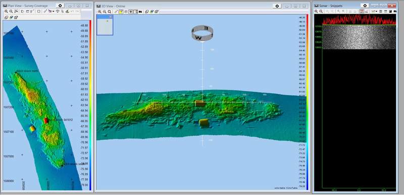
The Dutch Wreck
"Dutch Wreck" -- Steamship Laertes The Dutch steamship Laertes was built in 1919 by Taikoo Dockyard Engineering Company, Hong Kong. Owned by Nederland Stoomy, she was 423.9 feet long, had a 52.3 foot beam, displaced 5,825 tons and was pushed by a...
Contest
SeaBat 7125-SV2 tracking exposed pipeline in SeaBat UI
New SeaBat 7125-SV2 User Interface, wedge display with history turned on, tracking an exposed pipe with noticeable free span on a slope. At the end, start playing with Flex Mode.
Contest
Offshore Reef Multibeam Survey
Offshore reef in +/- 30 feet of water Data was collected using Teledyne PDS with the RESON Seabat 7125 mounted on "THE BEAST", Land Sea Surveying's 40 foot research and survey vessel.
product presentations
FlexMode used on Turbine
FlexMode used on Turbine
RESON data
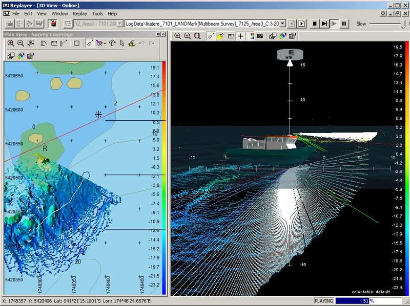
Taputeranga Pinnacles - Survey
Taputeranga Pinnacles - Survey
RESON data
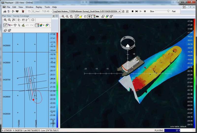
South Seas Wreck survey
South Seas Wreck survey
RESON data
Example of Full Rate Dual Head
RESON’s Feature Packs are a series of software and hardware upgrades that improves the functionality and performance by increasing features available on your SeaBat sonar. Feature pack 4 (FP4) is the latest release in the series and is...
Your stories
Environmental survey of the Thames barrier with the SeaBat 7101
Environmental survey of the Thames barrier with the SeaBat 7101
product presentations
SeaBat 7125-ROV2 using FlexMode for ultra-high density pipeline profiling
FlexMode is optimised for pipe inspection operations. An operator configurable centre sector is formed using very high density equi-angle beams and an underlying set of equi-distant beams provides coverage across the entire sector. FlexMode is...
RESON data
Survey of Port of Constanza in Romania Part 2
Port of Constance (Romania) surveyed using the SeaBat 7125 with POS MV Wavemaster and Riegle VZ400 laser scanner all collected and calibrated with Teledyne PDS. Go to part 1 Get more information about PDS2000 Software or the SeaBat 7125
Your stories
Survey of Port of Constanza in Romania Part 1
Port of Constance (Romania) surveyed using the SeaBat 7125 with POS MV Wavemaster and Riegle VZ400 laser scanner all collected and calibrated with Teledyne PDS. Go to part 2 Get more information about Teledyne PDS Software or the SeaBat 7125...
RESON data
Wreck survey with 7125SV2 and POSMV Wavemaste 2
Wreck survey with a RESON SeaBat multibeam sonar system 7125SV2 and POSMV Wavemaste Watch part 1 Get more info about the SeaBat 7125 multibeam sonar system
RESON data
Wreck survey with 7125SV2 and POSMV Wavemaste 1
Wreck survey with a RESON SeaBat multibeam sonar system 7125SV2 and POSMV Wavemaste Watch part 2 Get more info about the SeaBat 7125 multibeam sonar system
RESON data
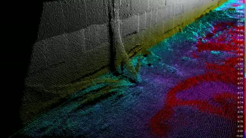
Quay Wall Inspection - SeaBat 8125
Inspection of a quay wall in Casablanca Morocco Harbour using a legacy Seabat 8125
Your stories
Deep water seafloor mapping using a SeaBat 8160
Deep water seafloor mapping using a SeaBat 8160 multibeam sonar. Get more information about the SeaBat 8160
Our stories
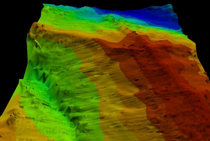
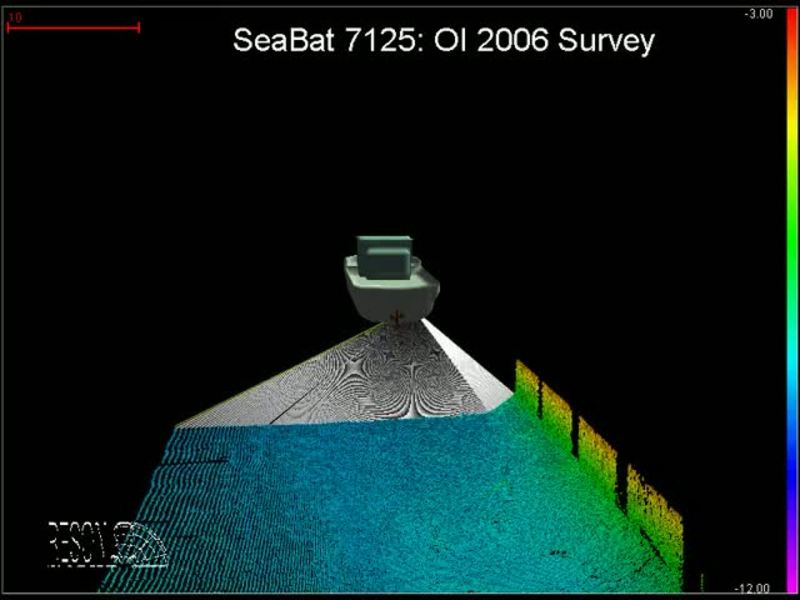
Hydrographic survey in the port of London with a SeaBat 7125
Hydrographic survey with a SeaBat 7125 multibeam sonar using Teledyne PDSs oftware in the port of London during the OI06 exhibition. Get more information about the Seabat 7125
Your stories
Seafloor mapping with a SeaBat 8125
Seafloor mapping with a SeaBat 8125 multibeam echosounder. Get more information about the SeBat 8125
Your stories
Subsea pipeline inspection with a SeaBat 8101
Subsea pipeline inspection in Texas with a SeaBat 8101 multibeam sonar system.
Your stories
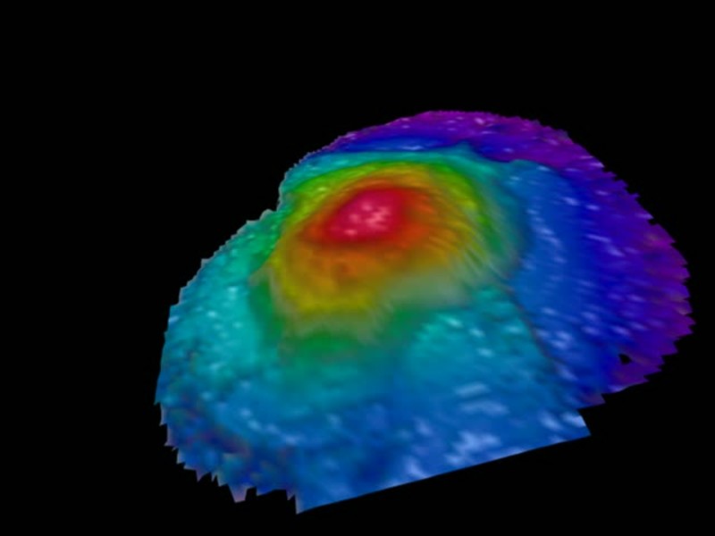
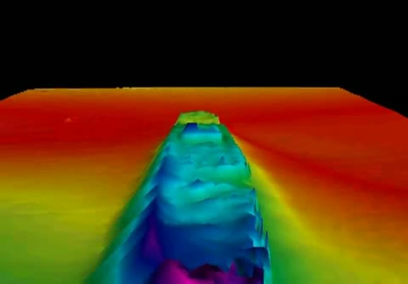
Sea mount near the Salomon islands detected using a SeaBat 7150
Sea mount near the Salomon islands detected by The Royal Danish Administration of Navigation and Hydrography using a SeaBat 7150 on the vessel "Væddderen" during the Danish Galathea 3 expedition in 2006/2007. Watch other videos from the...
Case stories
SS Richard Montgomery
Wreck of WWII Liberty Ship Lying in the Thames Estuary. This Wreck Survey is done using a RESON SeaBat 8125 Sonar and recorded using QINSy Animation by ADUS
Our stories
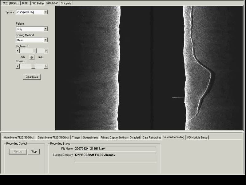
Objects seen with a 400kHz SeaBat 7125 multibeam sonar
Objects seen with a 400kHz SeaBat 7125 multibeam sonar in side scan module. Visit RESON SeaBat 7125 product page
Your stories
Atlantic Herring School using SeaBat 7125 Multibeam sonar
Detection and analysis of an Atlantic herring school using a SeaBat 7125 multi-beam echosounder from RESON. Get more info on the SeaBat 7125: http://www.reson.com/products/seabat/seabat-7125/
Your stories
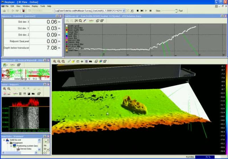
Speed boat discovered using a SeaBat 7125 in Lake Conroe
Speed boat discovered on the floor of Lake Conroe, Texas, USA during a demonstration of SeaBat 7125-SV Multibeam sonar system. The party boat "Soleil du Soir" was used as survey boat for the demonstration. Get more information about the SeaBat...
Your stories
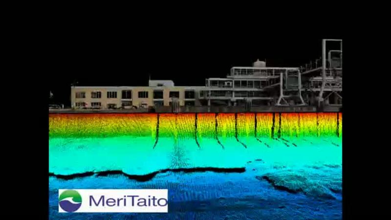
Photorealistic quay side inspection using laser and Seabat 7125
Combining terrestrial laser scanning together with high resolution SeaBat 7125 multibeam data gives you a photorealistic view of an area of interest. Dataset collected by the Finnish company Meritaito Oy.
Your stories
Fishes over the HMS Yukon SeaBat 7125 multibeam survey
Fishes over the wreck of the class-C destroyer HMS Yukon outside San Diego, USA detected with a SeaBat 7125 multibeam sonar system. HMS Yukon lies at a maximum depth of 100 feet, where it is a part of an artificial reef.
Our stories
Wreck of Blücher SeaBat 7125 multibeam sonar survey
RESON SeaBat 7125 multibeam sonar surveys the Oslo Fiord in Norway in 2007. The wreck of the Blücher, which was a German heavy cruiser sunk during the World War II, lies on 75 meter depth.
Case stories
3D visualisation of the wreck of HMS Royal Oak
3D visualisation of the wreck of HMS Royal Oak on the seabed of Scapa Flow Orkney made by Adus. Learn more about Teledyne RESON multibeam echosounders
Your stories
Deep water seafloor mapping near St Thomas -using SeaBat 7150
SeaBat 7150 multibeam sonar data collected near St. Thomas in the Caribbean Sea on depths down to 4400 meter during the Galathea 3 expedition. Courtesy of and copyright by The Royal Danish Administration of Navigation and Hydrography. Galathea...
Your stories
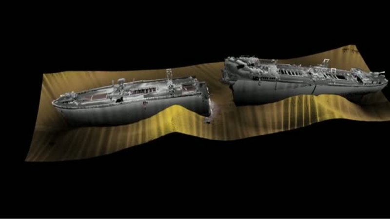
ADUS/Reson survey trial on SS Breda using SeaBat 7125
SS Breda, surveyed during a joint ADUS/Reson SeaBat 7125 trial in February 2010, using the 512 beam equi-angle data. Courtesy of ADUS. The SS Breda was a 6,941 ton Dutch cargo steamer launched in 1921.[1] Shaken by nearby bombs dropped from a...
Your stories
Discovering the Wreck of TSS Currajong using a SeaBat 8125
RESON SeaBat 8125 multibeam sonar survey in Port Jackson (Sydney Harbour)in year 1999. TSS Currajong sank in 1910 after being hit amidship by SS Wyreema near Bradleys Head. Currajong was a 603 tons, three masted steamer built to carry passengers....